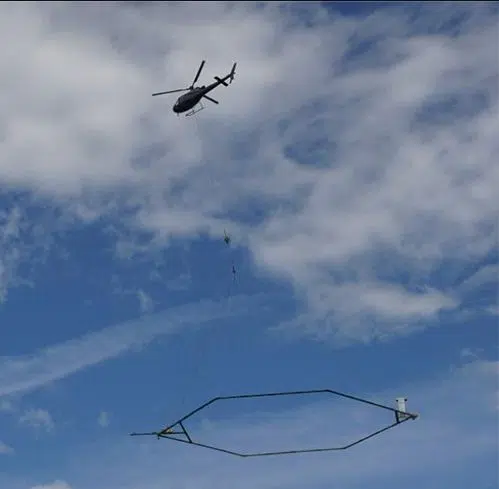
The U.S. Geological Survey says there’s nothing to worry about when a helicopter flies just a few hundred feet from the ground with a hoop hanging below it. That helicopter is part of a mapping survey being done in Illinois and Indiana in the next three or four weeks. It’s detecting radio signals to be used in determining where underground features are. It will fly along the Illinois River and in areas many miles from it. The helicopter will fly so low you won’t see it for long.
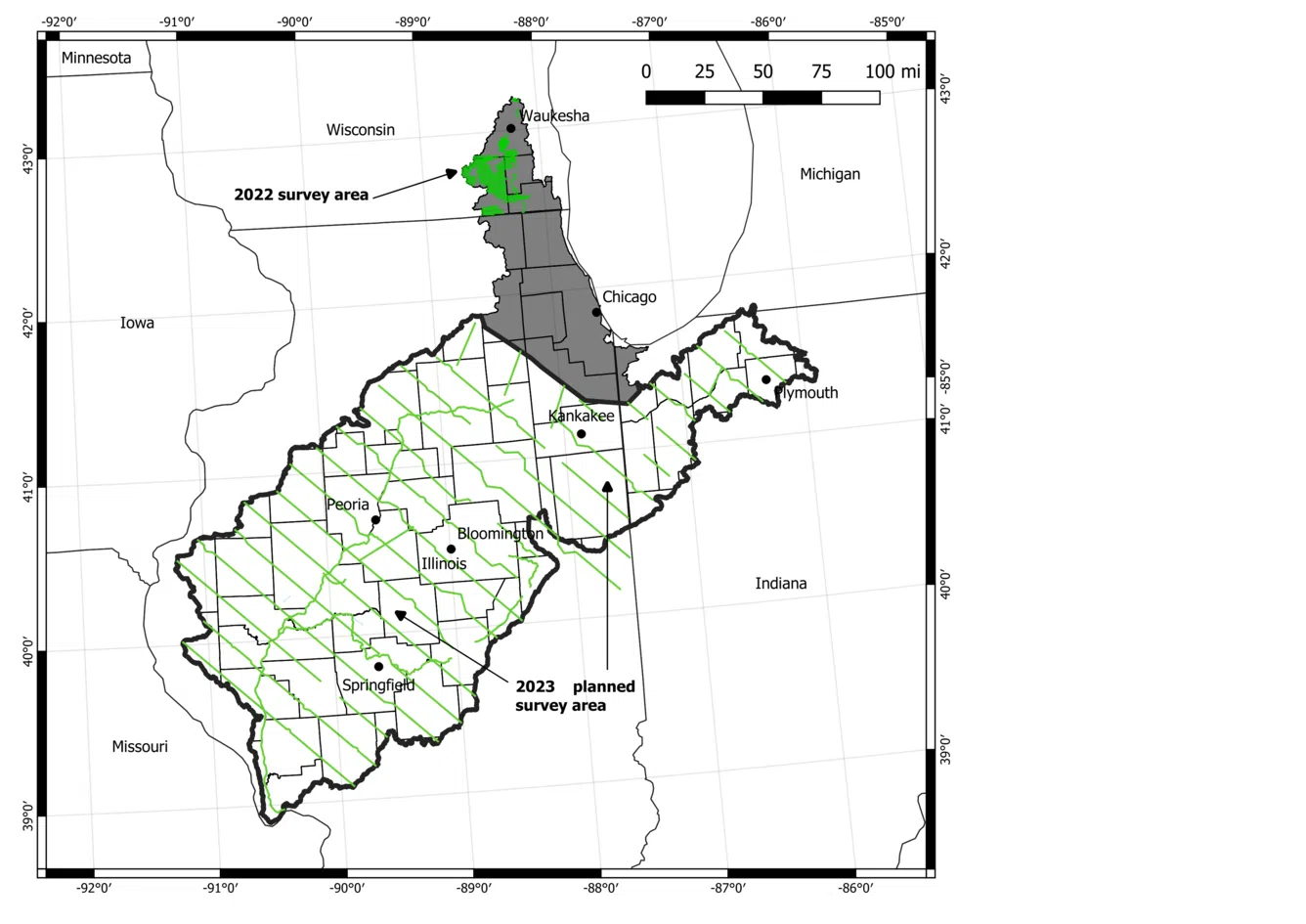
U.S. Geological Survey image showing the map survey area for January and February 2023